Empty Pipes
Europe by Train
I like travelling. I like trains. I don’t particularly like making decisions. Thus when deciding where to travel to with a train, it would be nice to know which areas are accessible. Taking inspiration from Beau Gunderson’s route times in Seattle, I decided to create maps showing which places are accessible by train from four of Europe’s major cities: London, Paris, Berlin and Vienna.
The methodology is simple. I used the Swiss public transport API to get the best connection between the start city (London, Paris, Berlin and Vienna) and every other city in Europe (huge thanks to @internetztube for a listing of European trains stations). Then I created a grid over all of Europe and interpolated the time to each point on the grid by assuming that any location that wasn’t a train station could be walked to at a rate of 10 minutes per kilometer. The results show a interconnected web of easy-to-reach locations criss-crossing the disconnected countryside.
Darker blue colors indicate a shorter travel time. Colors are proportional to the log of the total estimated travel time. No legend is provided, but clicking on the image leads to a larger interactive version overlayed on OpenStreetMap.
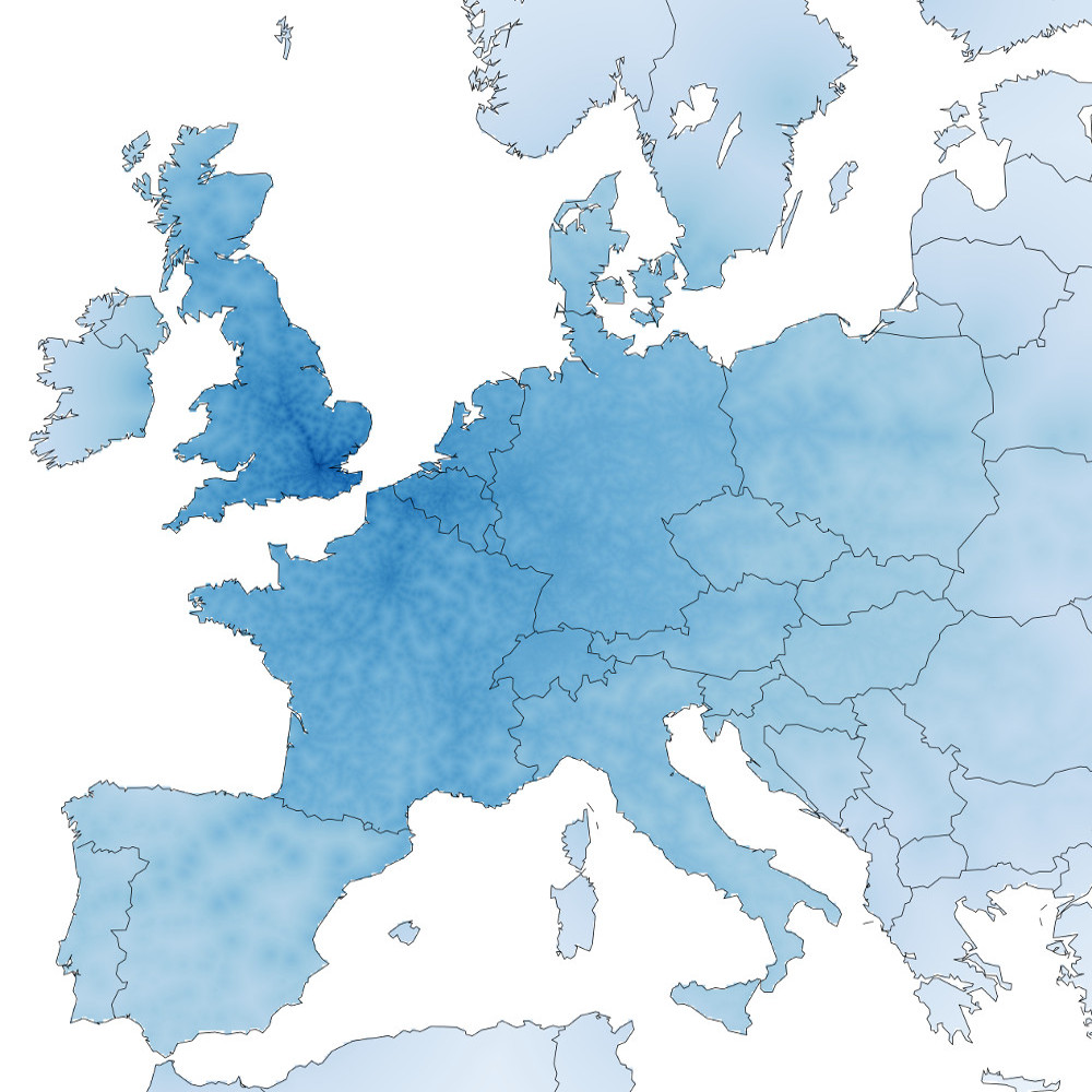 London
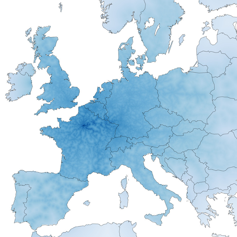 Paris
Paris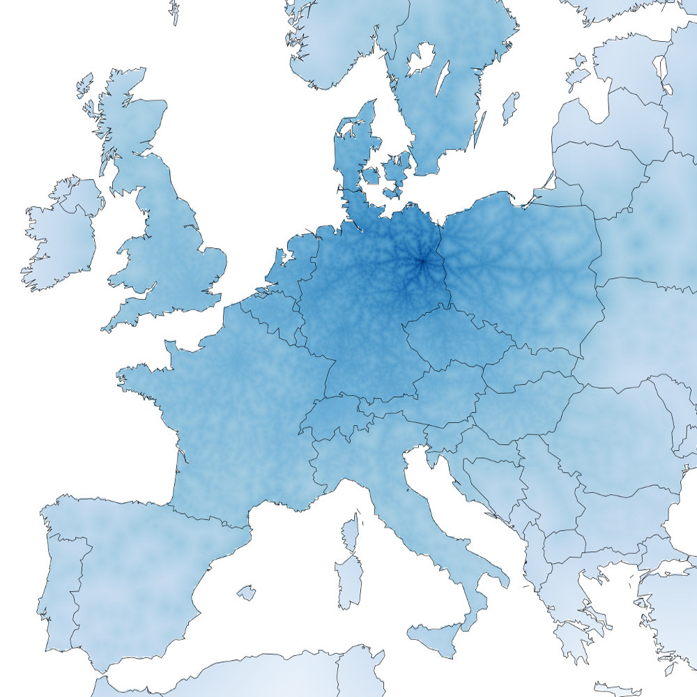 Berlin
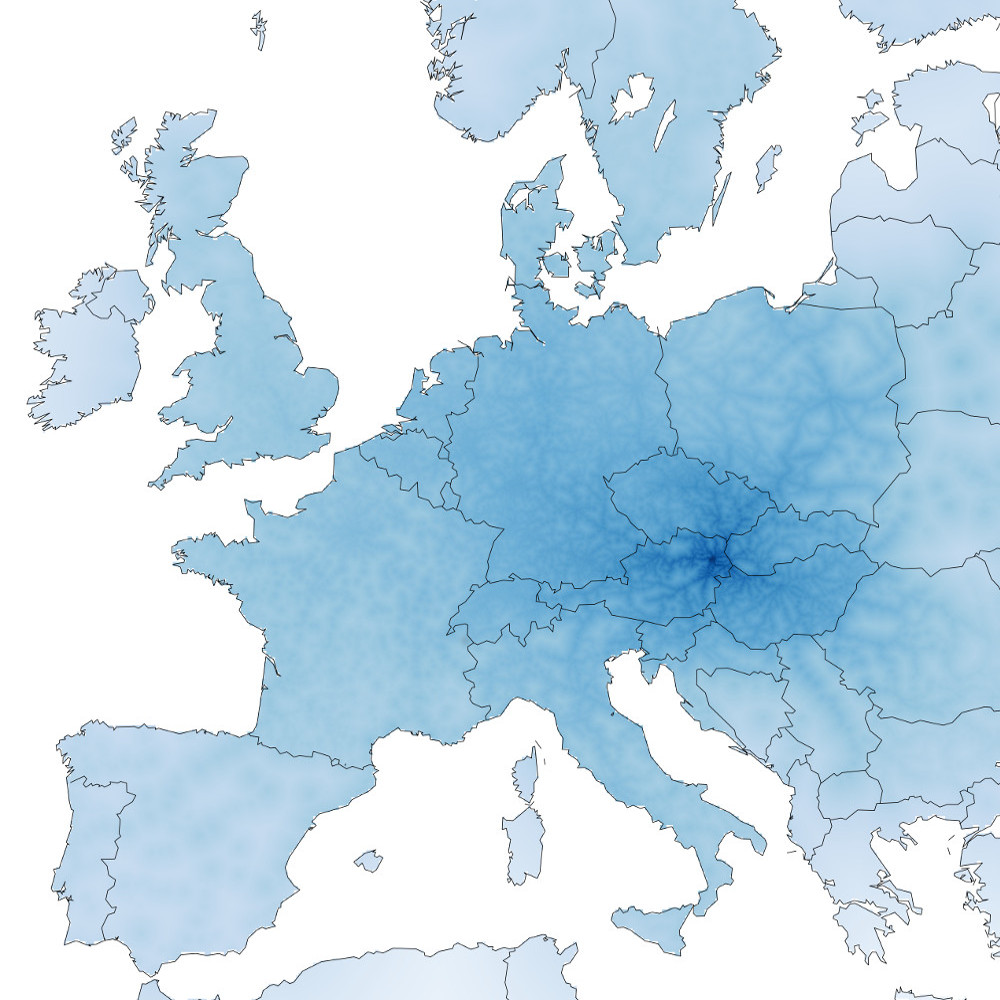 Vienna